Solutions · Power Lines
Inspect critical infrastructure with confidence.
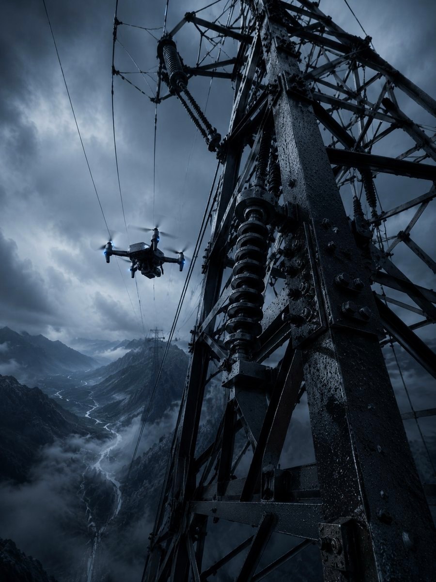
Transmission corridors run for kilometers across rough, exposed terrain. The towers that need a closer look are often the farthest from anywhere you can launch. RangeIQ+ models the energy budget of every leg, so you know, before you drive out, which spans your battery can actually reach and return from.
The Challenge
Long corridors, thin margins.
Linear assets push a drone to the edge of its range. The hard part is not flying out. It is having enough battery left to come home from the far end of a span you may have only reached once you were already in the air.
Remote Towers
The structures that most need inspection sit far from any road or launch point, deep into a corridor and well into the battery's reserve.
Rough Terrain
Climbs over ridges and valleys cost real energy. A flat-distance estimate hides the elevation that quietly eats your margin.
Exposed Wind
Ridgelines and open spans catch crosswind and headwind that change leg by leg, and that changes how far home really is.
How RangeIQ+ Helps
Physics for every span.
Per-Leg Corridor Range
Each tower-to-tower span is modeled on its own load, so a long corridor is judged segment by segment rather than on a single route-wide average.
RTH From the Farthest Tower
A return-to-home reserve is computed from the deepest point of the route, so the question of getting back is answered before you commit to flying out.
Wind & Terrain in the Budget
Wind on exposed ridgelines, climbs over rough terrain, and temperature all fold into each leg's energy budget instead of being left to a safety guess.
Payload-Aware Sensors
Sensor and gimbal payloads change the aircraft's mass and draw. RangeIQ+ adjusts the physics to the rig you actually carry down the line.
Drone Profiles Per Airframe
Predictions are modeled per airframe, so the corridor plan tracks the specific inspection drone in the case, not a generic stand-in.
A Clear Feasibility Verdict
One pass / watch / fail for the whole corridor, with the binding constraint named, so a marginal span is flagged before the crew is on site.
Outcomes
Plan the line before you reach it.
Outcome
Longer Corridors, Within Limits
Plan how far down a corridor a single sortie can reach while still landing with margin, instead of cutting routes short to stay safe.
Outcome
Know Where to Relaunch
See which towers fall outside reach from a launch point, and decide on a relocation or relaunch before you ever drive out to them.
Outcome
Fewer Aborted Flights
Catch the marginal span on the ground, so fewer missions turn back early and crews spend their time inspecting, not retreating.
Take the guesswork out of the corridor.
Request access to RangeIQ+ and bring per-leg feasibility to your next transmission inspection. The verdict drops into your existing flight and fleet tools through the Noxdren API.
Get API Access →